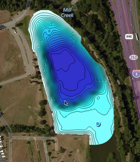
Insight Genesis‘ cloud-based software does all the work, automatically processing the sonar data you upload to create your custom maps.
Free and Premium subscribers can easily create, use and store unlimited custom maps with adjustable, high-resolution contour lines, depth-transition shading, automatic and manual depth offsets, and notes, tags and waypoints.
I have made two custom maps of Walter Wirth Lake in Salem, Oregon as of 02/22/17. I added these to my GOFREE account and they have now been merged and added to the Insight Genesis Social Map. As I add additional custom maps of Walter Wirth Lake to my GOFREE account any new data points will be added to the Insight Genesis Social Map for this lake. Likewise, if anyone else were to create custom maps for Walter Wirth Lake, any new data will be added to the Insight Genesis Social Map for the lake. The idea is that over time as folks contribute their data to the social mapping database a given body of water will grow. This is a great example of crowdsourcing.


